Tulsa Pantry Gap Map
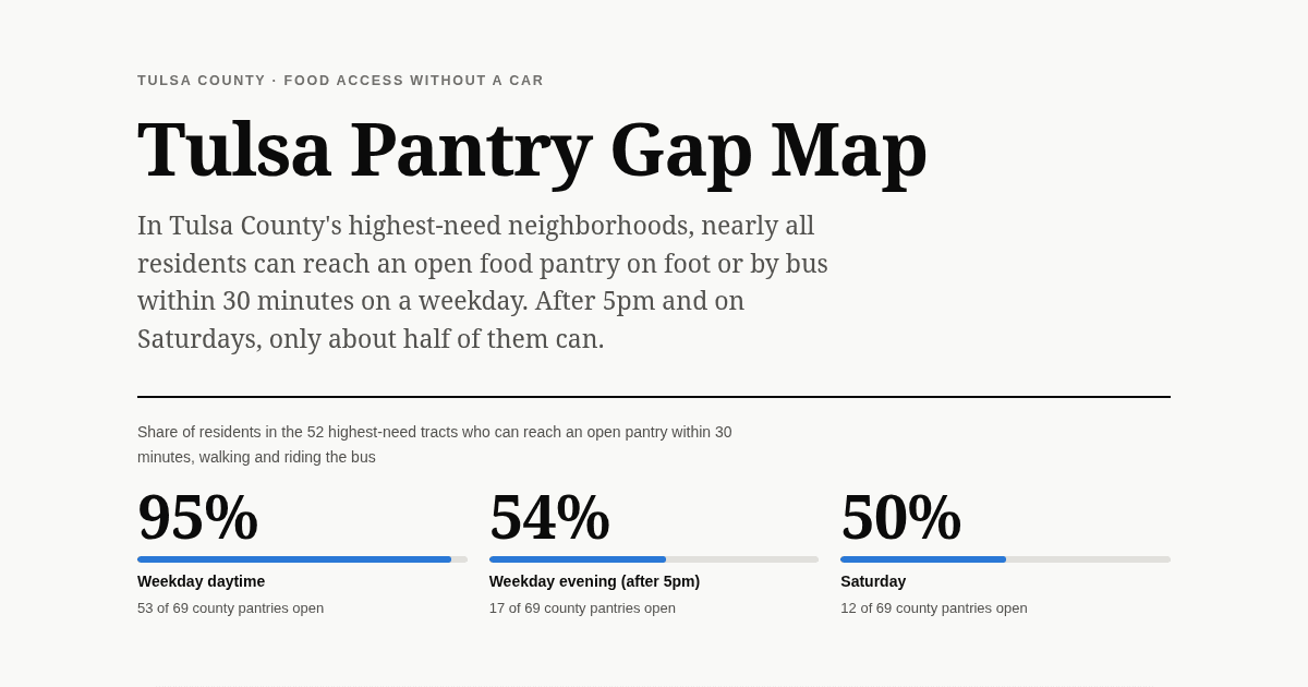
95% → 50%
high-need residents who can reach an open pantry without a car, weekday vs Saturday
Tulsa Pantry Gap Map asks a narrower question than most food-access maps: not whether a neighborhood is near a pantry, but whether that pantry is open when a working parent without a car can get there. A Python and GeoPandas pipeline builds a need index from ACS poverty, zero-vehicle, and SNAP data, reads pantry locations and their weekly hours (including "2nd and 4th Saturday" rules and service-area limits) from the Food Bank of Eastern Oklahoma's public Food Finder, and estimates walk-and-bus travel times from every populated census block using MetroLink Tulsa's published schedule, separately for weekday daytime, weekday evening, and Saturday. The bus shortcut is checked against a full timetable router (R5) and agrees for 93 to 98 percent of residents. The answer turned out to be timing more than location: pantries cluster where need is highest, but most close by 5pm and few open on Saturday. The phone-first static site has a tract map with toggles for each time window and for how riders wait for the bus, ranked gap tracts, a first-cut screen for where a mobile pantry would help most, and a methodology section that keeps the ACS margins of error, stale pantry hours, and the limits of tract averages in view. Published via Cloudflare Pages.
Sources
- US Census Bureau
- USDA ERS
- MetroLink Tulsa
- Food Bank of Eastern Oklahoma
Data Window
2020–2026